LIA® Laser Impulse Snow Height Acquisition
By 2025, 48 LIA® laser scanners had been installed worldwide
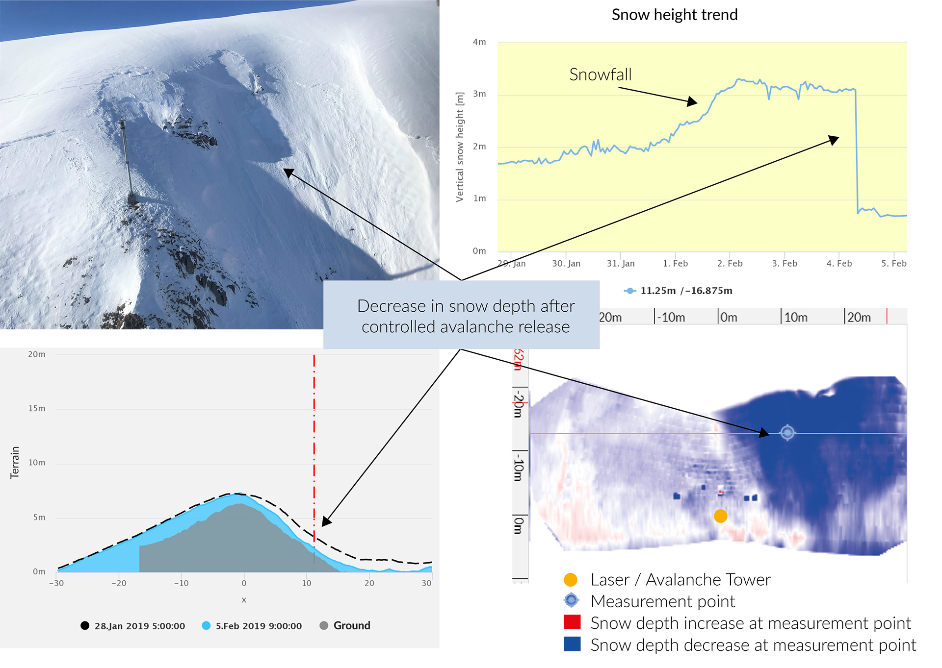
Unlike traditional snow depth measurement stations, which are generally installed in flat areas, LIA® acquires the snow-cover directly in the slope of the release areas. Covering an area as big as an ice-hockey field, not only can it measure the absolute snow depth, but also precisely quantify and map wind-drift and fracture-lines of avalanches.
Advantages
- 3D Laser measurement of changes in the snow accumulations in the avalanche release area (initiated by snowfall, wind and avalanche releases)
- Completely autonomous Operation
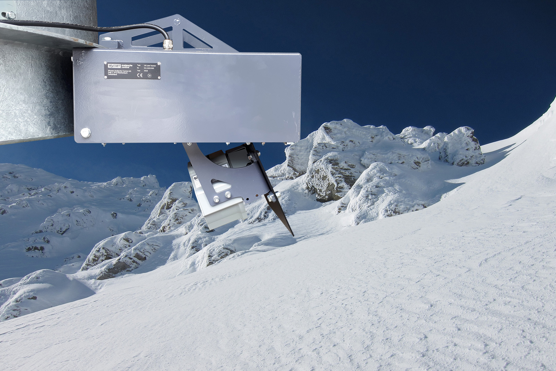
- Easy to mount: attachable to Wyssen avalanche towers LS12-5 and LS6-5
- Low cost due to using power supply and data connection from the Wyssen Avalanche Tower
Laser
Functional principle
LIA® scans the surface of the snow-cover in customizeable intervals. Each scan collects up to 44’000 points. Each point represents a distance from the snow cover (or any other object) to the scanner unit. These measurements are then immediately sent to the servers to be evaluated. The illustration on WAC.3® is a powerful tool which helps to measure not only snow height over time at different points but also lets you see the distribution of snow as well as results of avalanche control and even natural releases.
Technical data
| LIA® Specifications | Description |
|---|---|
| Scan Range | 120° horizontal, 120° vertical |
| Operational Range | 30 m (100 ft) radius around the avalanche tower (depends on terrain) |
| Scan resolution | 0.13° horizontal angular resolution, 2.5° vertical scan resolution |
| Scan Intervals | 1-6 h (automatic) |
| Temperature Range | -20°C to +60°C (-4°F to 140 °F) |
| Weight | approx. 25 kg (55 lbs) |
| Display | fully integrated with the Wyssen Avalanche Control Center WAC.3® |
| Power supply | via Wyssen Avalanche Tower |
The below screenshot demonstrate a scenario on WAC.3® in Davos (Switzerland).
Note for our registered trademarks ®: > Link to impressum
Laser