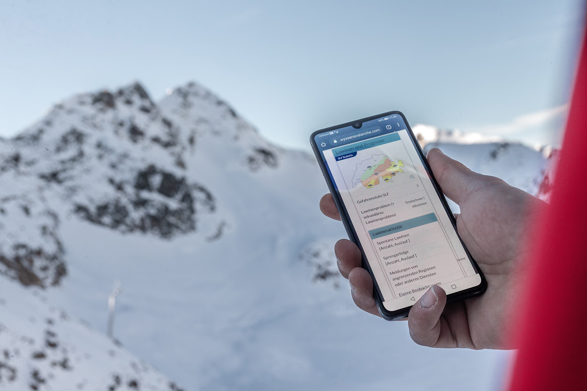
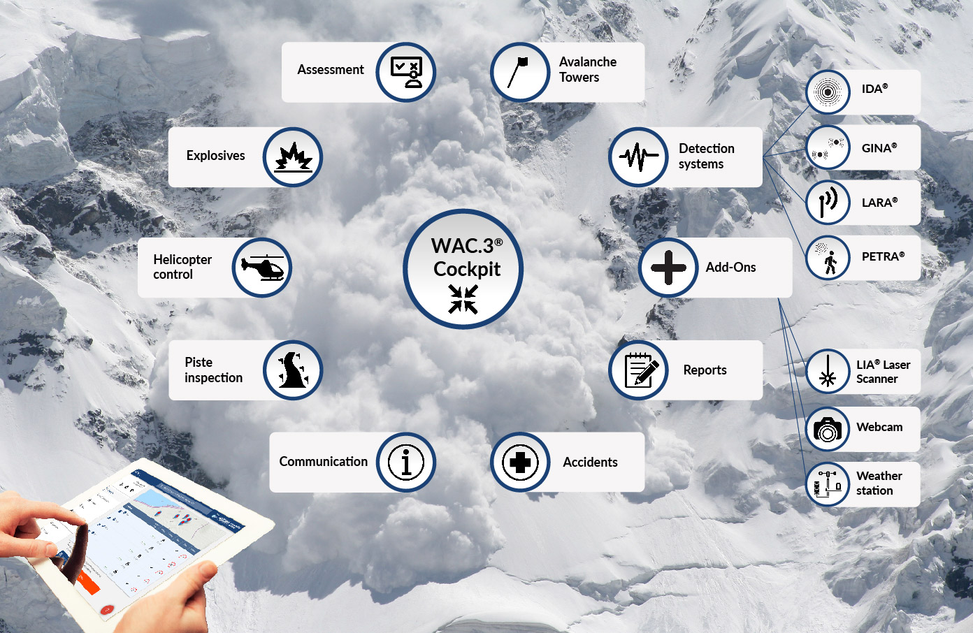
WAC.3® Cockpit and Additional Modules

one view
all information
one provider

Integration in WAC.3®

combining all relevant data

Safety through documentation
Safety through innovation
Safety through communication

Previous slide
Next slide

The integration of all technolgies, systems and information in one single platform.

user-friendly

Avalanche protection, mapping, camera monitoring, current weather data, internal communication and much more are combined on one platform. The tedious search for the relevant data is over.

fully integrated

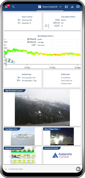
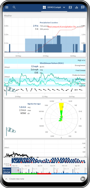
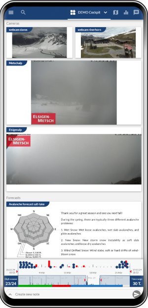
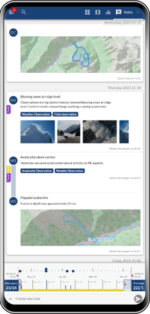
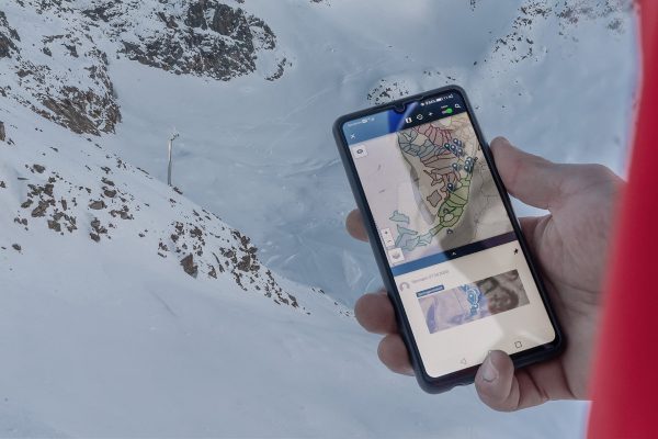
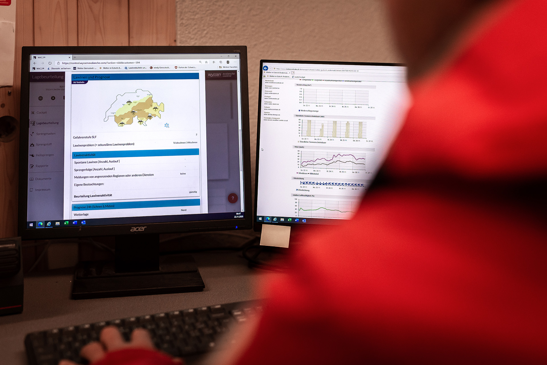
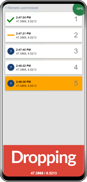
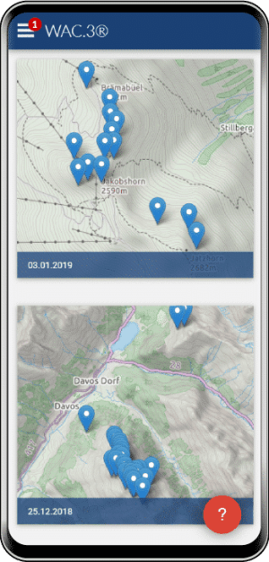
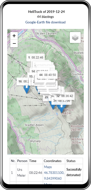
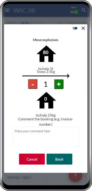
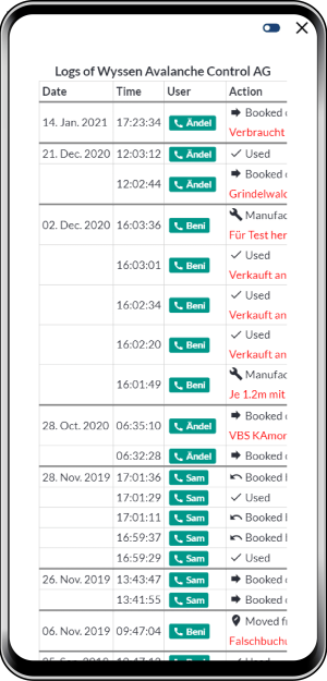
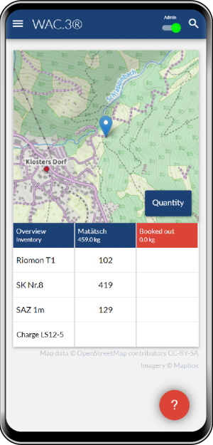
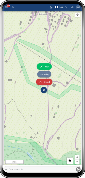
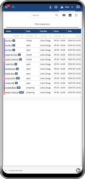
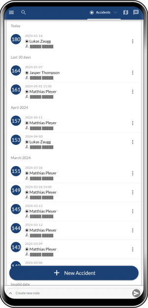
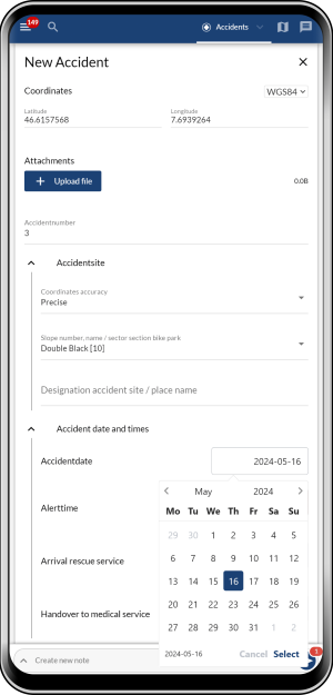
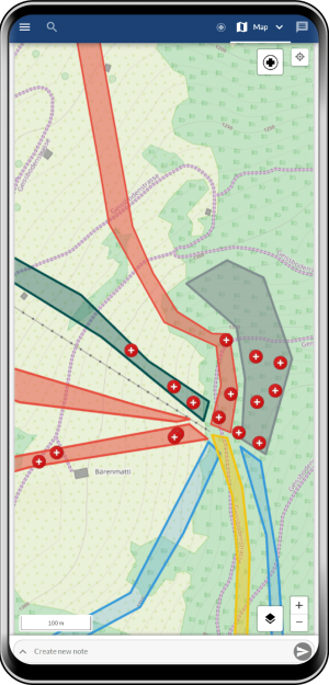
In addition to the operation of the avalanche towers, the web-based software WAC.3® enables, among other things, keeping inventory of explosives, process-controlled risk analysis, modeling of the snow cover or the location of helicopter blasting.

independent of location

All these options can be conveniently monitored and taken care of from your mobile phone, PC or tablet – regardless of location.

The big plus of the new cockpit platform is how easy it is to use. I don’t want to have to spend hours looking for important data on different program levels. This applies to the weather and status check I perform I every morning; I can prioritize the relevant sources and logs as well as any applications that I might only access every couple of weeks. Even with staff changing frequently or being new on the job, they can very quickly find their way; this is really very important for providing current information and for internal communication via WAC.3®.

serafin_siegele

Cockpit

The cockpit is a data collection platform for data assessment, operation and documentation. It offers an individual overview of relevant data such as weather stations, weather forecasts, avalanche bulletins, detection systems, observations and much more.

In the 2022/23 winter season, 50 operational cockpits were in use worldwide. A total of 17,368 notes were recorded.

The WAC.3® has proved to be the right software for mapping and documenting the professional activities and assessments of the ski patrol and rescue service. The Cockpit gives every authorized person live data from ongoing situation assessments and precision avalanche protection (GPS data) as well as the activities and events in day-to-day operations. This makes the snow operation and the briefings/debriefings extremely professional. The WAC.3® is also our log of any event tracking our activities at all times and allowing us to demonstrate that nothing was neglected, providing a backup to the information provided by shift supervisors and company management. After a season of intensive work with the WAC.3®, we can hardly imagine a professional rescue service without it.

andermatt1
Cockpit_infos_en

Map view and journal in the Cockpit

kartenansicht
raphael_imsand
Raphael Imsand, Head of the Regional Safety Service – Natural Hazards Goms (RSD-GOMS)

RiskEval

provides risk analysis and action planning. Risk Eval is a process-based risk assessment and planning of measures. The prerequisite is a current and well-founded security concept developed by an engineering office with appropriate experience. A “showcase example” of this is the project in Goms.

A total of 3799 Risk Evaluations were closed during the whole winter season 2022/23.

Project in Goms

Region: Municipality of Goms in Valais (Switzerland)
Safety Concept: Company Geoformer igp AG

Since winter 18/19, an avalanche safety concept has been operational in the Goms region. The concept was developed by the engineering office geoformer igp AG in Brig with the Regional Safety Service (RSD) Goms and Raphael Imsand. The concept takes into account all avalanche protection measures that are numerous in Goms with the aim of reducing closure times, but more recently also to be able to close and open individual sections within Goms independently of each other. Since the winter of 19/20, this concept has been successfully implemented on the WAC.3® platform. The WAC.3® platform enables RSD Goms to display all relevant information such as snow and weather data, weather forecasts, webcams or even SLF products at a glance. In addition, the avalanche detection systems in Goms are integrated in a clearly arranged format. In Wyssen RiskEval, the complex workflow from snowpack assessment to situation evaluation to a decision on measures is mapped in a much leaner and more user-friendly way. Thanks to automatic documentation of the decisions, their justification and the underlying data, the compliance with the duty of care, which is central for the work of an avalanche warning service, is guaranteed. The WAC.3® platform could thus simplify the work of RSD-Goms and contribute to avalanche safety in the region.

More information about the project in Goms (VS) can be read here:

Impressions from Andermatt

HeliTrack

HeliTrack documents the avalanche explosions from the helicopter. The location, time and success of blasting operations in helicopters can be easily recorded on the move.
helitrack4

ExploDoc

The ExploDoc module is used for keeping accurate explosives inventory.
The module enables intuitive booking of simple warehouse entries and exits. Storage and product information can be stored and all activity logs documented.

explodoc

PisteCheck

With PisteCheck reduces the administrative effort for slope checks and slope conditions to a few swipes on the cell phone. Irregularities can be documented with a photo and text for each slope. If required, runway checks are displayed centrally in the cockpit journal along with all other relevant information and thus offer simple traceability.

andermatt_prd

RescueDoc

The accident is recorded with RescueDoc in two steps: at the scene of the accident, only the most important information such as GPS location (automatically), photos and, if necessary, further information is recorded with the cell phone, so that there is more time for patient care. Back in the office, the accident form can be completed and various exports can be used to forward the accident data for invoicing, etc. If required, the accident entry form can be customized. In combination with PisteCheck all slopes also appear directly on the overview map of RescueDoc and as a list in the accident form. Accident evaluations can be easily carried out via an overview map or CSV export. The protection of sensitive patient data is guaranteed.

All modules in the overview:

It’s always astonishing how much time our customers spend every day collecting data and documenting. The aim of the cockpit is to reduce these important tasks to just a few clicks. This should give our customers more time for their actual work: making careful decisions and implementing what they decide.

beni_meier
walter_steinkogler

Practitioners must collect and assess a large amount of information in a very short time. The integration of the relevant information on a single platform is therefore the logical next step and it is precisely this interface that represents the great added value of the WAC3® cockpits.

Note for our registered trademarks ®: > Link to impressum